GEOGRAPHIC INFORMATION SYSTEMS
Geographic Information Systems
The SRCOG maintains a (GIS) Geographic Information System. This computer program has enabled the SRCOG to produce maps for our municipalities. GIS Services can be provided to our members as requested.
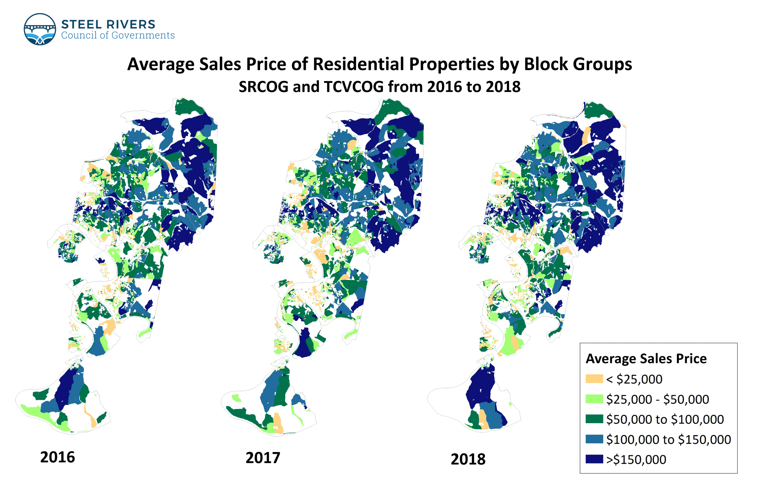
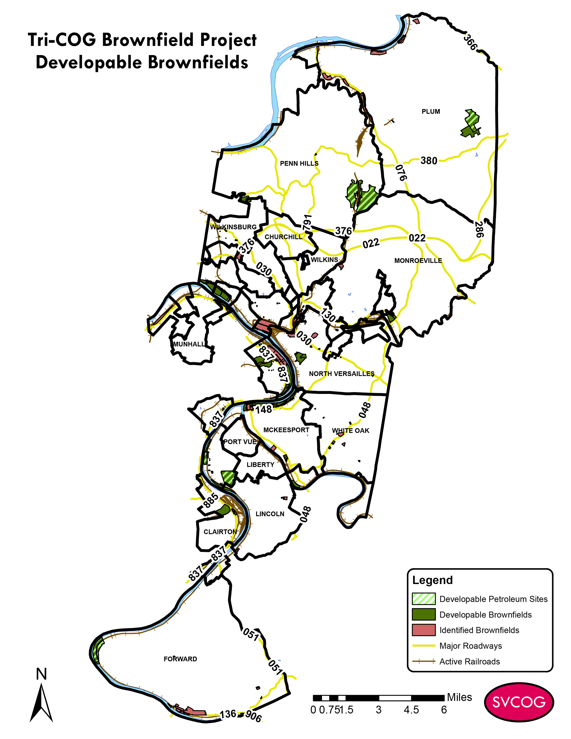
In addition to providing GIS services to our members, the SRCOG also uses GIS as part of key research projects. For example, to support the Fight Blight Strategy Program, SRCOG mapped vacant, blighted and tax delinquent properties. SRCOG also mapped vacant commercial lots for the EPA Brownfield Grant Project, and this data was incorporated into the Healthy Housing Market Analysis and Commercial Corridor Analysis projects. Our GIS is an important tool for the Tri-COG Land Bank.
Examples of GIS Maps